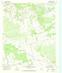
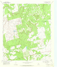
1969 Map of Royston
USGS Topo · Published 1973About this map
The Missouri Kansas Texas railroad cuts a diagonal line across this West Texas landscape, connecting the small settlement of Royston to the broader regional economy. Situated in Fisher County, the terrain is defined by the winding course of the Clear Fork Brazos River, which flows through the southwestern portion of the sheet near Roby. The map documents a rural environment where agricultural land meets industrial utility, evidenced by the extensive Oil Field in the northeast and scattered wells throughout the territory. Local history is anchored by features such as the Roby Cem and Kyle Spring, while the presence of a Roadside Park and several gravel pits indicates the infrastructure supporting mid-century transit and local industry. This 1960s survey preserves the spatial relationship between the river's drainage system, including Cottonwood Creek and Sandy Creek, and the human imprint of ranching and petroleum extraction.
Find a feature on this map
12 named features on this map. Tap any name to fly to it.
Don’t see what you’re looking for? This feature index may not catch every label — zoom into the map to look around manually.
Map Details
Editions of this 1969 Royston Map
2 editions found
Other maps of this area

1893 · Roby
USGS Topo · 1:125,000

1926 · Roby 2-b
USGS Topo · 1:48,000

1931 · Rotan
USGS Topo · 1:62,500

1954 · Big Spring
USGS Topo · 1:250,000

1957 · Noodle
USGS Topo · 1:62,500

1958 · Big Spring
USGS Topo · 1:250,000
1965 · Hamlin NW
USGS Topo · 1:24,000

1965 · McCaulley
USGS Topo · 1:24,000
1969 · White Canyon
USGS Topo · 1:24,000
1969 · Poke Mountain
USGS Topo · 1:24,000