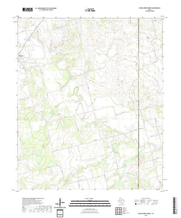
2022 Map of Raven Creek North
USGS Topo · Published 2022About this map
Sylvester sits at the northwestern edge of this West Texas landscape, where the agricultural grid meets the winding course of the Clear Fork Brazos River. The terrain is defined by a dense network of seasonal drainages, including China Cr, E China Cr, and Dry Cr, which carve through the plains toward the river basin. This area along the boundary of Fisher County and Jones County reflects a mid-20th-century rural infrastructure, with farm-to-market roads like FM 57 and FM 1812 N connecting isolated homesteads and ranching tracts. The map captures the subtle elevation changes of the rolling prairie, illustrating how water access and county lines dictated the placement of early ranch roads and settlements in this part of the Rolling Plains.
Find a feature on this map
30 named features on this map. Tap any name to fly to it.
Don’t see what you’re looking for? This feature index may not catch every label — zoom into the map to look around manually.
Map Details
Editions of this 2022 Raven Creek North Map
This is the sole edition of this map. No revisions or reprints were ever made.
Other maps of this area

1893 · Roby
USGS Topo · 1:125,000

1931 · Rotan
USGS Topo · 1:62,500

1954 · Big Spring
USGS Topo · 1:250,000

1957 · Noodle
USGS Topo · 1:62,500

1958 · Big Spring
USGS Topo · 1:250,000
1965 · Neinda
USGS Topo · 1:24,000

1965 · McCaulley
USGS Topo · 1:24,000

1969 · Eskota
USGS Topo · 1:24,000
1969 · Longworth
USGS Topo · 1:24,000
1969 · Royston
USGS Topo · 1:24,000