1975 Map of Raven Rock
USGS Topo · Published 1979About this map
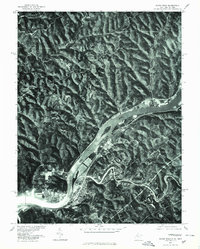
The Ohio River cuts through the center of this 1970s orthophotoquad, defining the border between West Virginia and Ohio. This specific aerial perspective, produced in cooperation with the Soil Conservation Service, offers a clear view of the mid-decade riverfront layout and land use. On the West Virginia bank, the settlement of St Marys sits near the confluence where Middle Island Creek meets the river, showing the town's position relative to the surrounding topography and water. Opposite the river in Ohio, the community of Newport is clearly visible, while further upriver on the West Virginia side lies Raven Rock. This map is particularly useful for researchers studying the mid-twentieth-century industrial or residential footprints along the river corridor before later developments altered the shoreline and town boundaries.
Find a feature on this map
5 named features on this map. Tap any name to fly to it.
Don’t see what you’re looking for? This feature index may not catch every label — zoom into the map to look around manually.
Map Details
Editions of this 1975 Raven Rock Map
This is the sole edition of this map. No revisions or reprints were ever made.
Other maps of this area

1903 · Macksburg
USGS Topo · 1:62,500

1904 · Marietta
USGS Topo · 1:62,500

1905 · New Matamoras
USGS Topo · 1:62,500

1905 · Macksburg
USGS Topo · 1:62,500

1906 · Saint Marys
USGS Topo · 1:62,500

1924 · St Marys
USGS Topo · 1:62,500

1924 · New Matamoras
USGS Topo · 1:62,500

1924 · Marietta
USGS Topo · 1:62,500

1926 · New Matamoras
USGS Topo · 1:62,500

1927 · Marietta
USGS Topo · 1:62,500