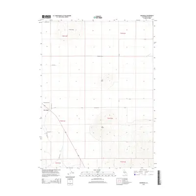
2015 Map of Ravendale
USGS Topo · Published 2015About this map
Ravendale sits as a central hub in this high-desert landscape of Lassen County, where the expansive Madeline Plains meet a series of prominent volcanic landforms. The settlement is defined by its proximity to the Ravendale Airport and a network of arterial roads like School House Rd and Chicken Ranch Rd, which suggest a history of ranching and rural education. To the north, Juniper Ridge rises above the plains, while the solitary heights of Dill Butte and the dual peaks of Twin Buttes punctuate the horizon to the east. Water is a scarce and vital element here, represented by the ephemeral Cold Spring Cr. The map preserves names of functional significance to local residents, including Mail Route Rd and Horse Lake Rd, reflecting the traditional logistics of this high-plateau region.
Find a feature on this map
23 named features on this map. Tap any name to fly to it.
Don’t see what you’re looking for? This feature index may not catch every label — zoom into the map to look around manually.
Map Details
Editions of this 2015 Ravendale Map
This is the sole edition of this map. No revisions or reprints were ever made.
Other maps of this area

1886 · Honey Lake
USGS Topo · 1:250,000

1891 · Honey Lake
USGS Topo · 1:250,000

1893 · Honey Lake
USGS Topo · 1:250,000

1954 · Observation Peak
USGS Topo · 1:62,500

1954 · Karlo
USGS Topo · 1:62,500

1954 · Ravendale
USGS Topo · 1:62,500

1954 · Shinn Mountain
USGS Topo · 1:62,500

1955 · Westwood
USGS Topo · 1:250,000

1958 · Westwood
USGS Topo · 1:250,000

1959 · Westwood
USGS Topo · 1:250,000