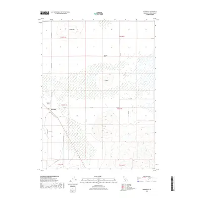
2018 Map of Ravendale
USGS Topo · Published 2018About this map
Ravendale sits as a primary junction in this high desert landscape of Lassen County, where the LLTT Modoc Line Rail Trail traces the path of former railroad activity across the Madeline Plains. The terrain is defined by isolated volcanic features like Dill Butte and Twin Buttes, which rise abruptly from the surrounding flats. Local infrastructure is sparse, concentrated around the Ravendale Airport and a network of arterial roads like School House Rd and Chicken Ranch Rd. To the north, the land ascends toward Juniper Ridge, while the eastern reaches are marked by seasonal drainage from Cold Spring Cr. The map preserves the transition from industrial rail use to recreational trails, alongside established ranching names that indicate the rural character of the region in the early twenty-first century.
Find a feature on this map
23 named features on this map. Tap any name to fly to it.
Don’t see what you’re looking for? This feature index may not catch every label — zoom into the map to look around manually.
Map Details
Editions of this 2018 Ravendale Map
This is the sole edition of this map. No revisions or reprints were ever made.
Other maps of this area

1886 · Honey Lake
USGS Topo · 1:250,000

1891 · Honey Lake
USGS Topo · 1:250,000

1893 · Honey Lake
USGS Topo · 1:250,000

1954 · Observation Peak
USGS Topo · 1:62,500

1954 · Karlo
USGS Topo · 1:62,500

1954 · Ravendale
USGS Topo · 1:62,500

1954 · Shinn Mountain
USGS Topo · 1:62,500

1955 · Westwood
USGS Topo · 1:250,000

1958 · Westwood
USGS Topo · 1:250,000

1959 · Westwood
USGS Topo · 1:250,000