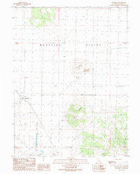
1989 Map of Ravendale
USGS Topo · Published 1989About this map
Ravendale stands as the primary settlement within this high-elevation landscape, situated along the edge of the expansive Madeline Plains. The geography is defined by volcanic features and semi-arid terrain, where prominent landmarks like Dill Butte and Twin Buttes rise above the flat plains. Resource extraction and infrastructure are evident through the presence of several Cinder Pits and a Borrow Pit, likely supporting local road maintenance or rail needs. The map captures a transition from the level basin of the plains to the upland topography of Juniper Ridge in the northwest. An Airport serves the small community of Ravendale, while scattered Well and Spring locations highlight the importance of water management in this high desert environment.
Find a feature on this map
14 named features on this map. Tap any name to fly to it.
Don’t see what you’re looking for? This feature index may not catch every label — zoom into the map to look around manually.
Map Details
Editions of this 1989 Ravendale Map
This is the sole edition of this map. No revisions or reprints were ever made.
Other maps of this area

1886 · Honey Lake
USGS Topo · 1:250,000

1891 · Honey Lake
USGS Topo · 1:250,000

1893 · Honey Lake
USGS Topo · 1:250,000

1954 · Observation Peak
USGS Topo · 1:62,500

1954 · Karlo
USGS Topo · 1:62,500

1954 · Ravendale
USGS Topo · 1:62,500

1954 · Shinn Mountain
USGS Topo · 1:62,500

1955 · Westwood
USGS Topo · 1:250,000

1958 · Westwood
USGS Topo · 1:250,000

1959 · Westwood
USGS Topo · 1:250,000