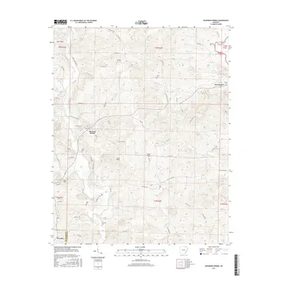
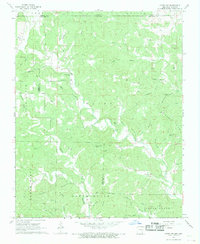
2017 Map of Ravenden Springs
USGS Topo · Published 2017About this map
Ravenden Springs serves as a central hub in this corner of Arkansas, where the landscape is defined by the winding course of Janes Creek and the high ground of Locust Ridge. The map reveals a deeply etched rural layout, with numerous family and community burial grounds such as Rickman Cem, Charter Oak Cem, and Kuhn Cem scattered across the township lines. These small cemeteries, often found near old farm roads like Sassafras Trl or Conrad Trl, provide critical touchpoints for genealogical research in Lawrence Co and Randolph Co. In the northeast, the Eleven Point River cuts through the terrain near the small settlement of Elevenpoint, while landmarks like Baker Bluff and Oaks Hill dictate the path of local travel. The network of primitive and improved roads, including Old Jackson Rd and Valley Chapel Rd, illustrates the persistent connectivity between isolated homesteads and these historic crossroads communities.
Find a feature on this map
81 named features on this map. Tap any name to fly to it.
Don’t see what you’re looking for? This feature index may not catch every label — zoom into the map to look around manually.
Map Details
Editions of this 2017 Ravenden Springs Map
This is the sole edition of this map. No revisions or reprints were ever made.
Other maps of this area

1934 · Powhatan
USGS Topo · 1:62,500

1935 · Powhatan
USGS Topo · 1:62,500

1957 · Poplar Bluff
USGS Topo · 1:250,000

1959 · Poplar Bluff
USGS Topo · 1:250,000

1960 · Poplar Bluff
USGS Topo · 1:250,000

1966 · Ravenden Springs
USGS Topo · 1:24,000
1966 · Ravenden Springs SE
USGS Topo · 1:24,000
1966 · Imboden
USGS Topo · 1:24,000
1967 · Warm Springs
USGS Topo · 1:24,000
1968 · Hardy NE
USGS Topo · 1:24,000