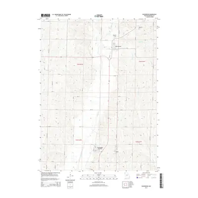
2014 Map of Ravenwood
USGS Topo · Published 2014About this map
Ravenwood sits as the primary settlement in this portion of Nodaway County, characterized by a structured grid of rural roads and fertile drainage basins. The Platte River meanders south through the center of the sheet, joined by various tributaries including Honey Cr, Munkres Br, and Wildcat Cr. To the south, the neighboring communities of Conception Junction and Clyde represent a significant local crossroads, with residential clusters oriented around Main St and Convent St. These towns serve as a hub for the surrounding agricultural landscape, which is divided into sections by the Public Land Survey System, including t64n r34w and t64n r33w. For those researching local families, the map identifies several burial sites such as Oak Lawn Cemetery north of Ravenwood and Sweet Home Cemetery located near the headwaters of Zounds Cr.
Find a feature on this map
44 named features on this map. Tap any name to fly to it.
Don’t see what you’re looking for? This feature index may not catch every label — zoom into the map to look around manually.
Map Details
Editions of this 2014 Ravenwood Map
This is the sole edition of this map. No revisions or reprints were ever made.
Other maps of this area

1925 · Stanberry
USGS Topo · 1:62,500

1927 · Bolckow
USGS Topo · 1:62,500

1939 · Stanberry
USGS Topo · 1:62,500

1940 · Parnell
USGS Topo · 1:62,500

1943 · Parnell
USGS Topo · 1:62,500

1943 · Maryville
USGS Topo · 1:62,500

1943 · Stanberry
USGS Topo · 1:62,500

1945 · Bolckow
USGS Topo · 1:62,500

1955 · Nebraska City
USGS Topo · 1:250,000

1957 · Nebraska City
USGS Topo · 1:250,000