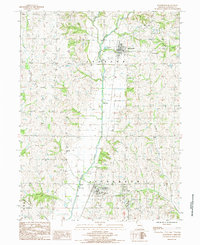
1985 Map of Ravenwood
USGS Topo · Published 1985About this map
The Platte River meanders through the heart of this landscape, its path marked by several Sand Areas and a Gaging Sta north of Conception Junction. This 1980s Missouri interior reflects a stable rural agricultural pattern, centered on the hubs of Ravenwood and the neighboring settlements of Clyde and Conception Junction. The topography is defined by the drainages of Long Branch and Wildcat Creek, which feed into the Platte valley, illustrating the critical role of river hydrology in shaping the region's townships.
Find a feature on this map
18 named features on this map. Tap any name to fly to it.
Don’t see what you’re looking for? This feature index may not catch every label — zoom into the map to look around manually.
Map Details
Editions of this 1985 Ravenwood Map
This is the sole edition of this map. No revisions or reprints were ever made.
Other maps of this area

1925 · Stanberry
USGS Topo · 1:62,500

1927 · Bolckow
USGS Topo · 1:62,500

1939 · Stanberry
USGS Topo · 1:62,500

1940 · Parnell
USGS Topo · 1:62,500

1943 · Parnell
USGS Topo · 1:62,500

1943 · Maryville
USGS Topo · 1:62,500

1943 · Stanberry
USGS Topo · 1:62,500

1945 · Bolckow
USGS Topo · 1:62,500

1955 · Nebraska City
USGS Topo · 1:250,000

1957 · Nebraska City
USGS Topo · 1:250,000