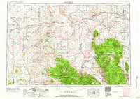
1958 Map of Rawlins
USGS Topo · Published 1958About this map
Continental Divide winds through this high-desert landscape, splitting the watersheds of the Great Divide Basin from the North Platte River drainage. In the late 1950s, the Union Pacific railroad corridor remained the primary artery of commerce, anchoring towns like Rawlins, Sinclair, and Hanna. The map illustrates a region in transition, where legacy coal operations are noted as Strip mine (abandoned) near Medicine Bow, while the presence of the Seminoe Reservoir and Arlington reflect the steady management of water and transit in the arid interior. To the south and east, the elevation rises sharply into the Medicine Bow National Forest, where peaks like Kennaday Peak and Elk Mountain overlook the Saratoga valley. This survey details a working landscape defined by ranching at Larsens Ranch, the geologic importance of Como Bluff, and the high-altitude forests of the Sierra Madre.
Find a feature on this map
100 named features on this map. Tap any name to fly to it.
Don’t see what you’re looking for? This feature index may not catch every label — zoom into the map to look around manually.
Map Details
Editions of this 1958 Rawlins Map
2 editions found

Other maps of this area

1893 · Fort Steele
USGS Topo · 1:125,000

1895 · Laramie
USGS Topo · 1:125,000

1902 · Laramie
USGS Topo · 1:125,000

1905 · Laramie
USGS Topo · 1:125,000

1906 · Medicine Bow
USGS Topo · 1:125,000

1906 · Laramie
USGS Topo · 1:125,000

1908 · Laramie
USGS Topo · 1:125,000

1908 · Medicine Bow
USGS Topo · 1:125,000

1911 · Hahns Peak
USGS Topo · 1:125,000

1913 · Hahns Peak
USGS Topo · 1:125,000