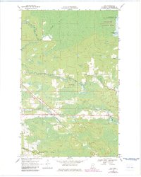
1969 Map of Ray
USGS Topo · Published 1983About this map
Ray serves as the primary settlement on this northern Minnesota landscape, situated where the Duluth Winnipeg and Pacific railway cuts through a mosaic of wetlands and forests. The map highlights the transition of the wilderness into protected lands, with the northern boundary of the Kabetogama State Forest meeting the southern edge of Voyageurs National Park at Kabetogama Lake. These public lands are intertwined with early industry and access, evidenced by a Gravel Pit and a primitive Winter Trail.
Find a feature on this map
13 named features on this map. Tap any name to fly to it.
Don’t see what you’re looking for? This feature index may not catch every label — zoom into the map to look around manually.
Map Details
Editions of this 1969 Ray Map
4 editions found
Other maps of this area

1919 · International Falls
USGS Topo · 1:62,500

1954 · International Falls
USGS Topo · 1:250,000

1957 · International Falls
USGS Topo · 1:250,000

1958 · International Falls
USGS Topo · 1:250,000

1963 · Ranier
USGS Topo · 1:24,000

1969 · Ray SE
USGS Topo · 1:24,000

1969 · Island View
USGS Topo · 1:24,000

1969 · Ericsburg
USGS Topo · 1:24,000

1969 · Ericsburg SE
USGS Topo · 1:24,000

1969 · Ray
USGS Topo · 1:24,000