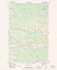
1969 Map of Ray
USGS Topo · Published 1987About this map
Voyageurs National Park defines the northeastern portion of this northern Minnesota landscape, where the waters of Kabetogama Lake meet a densely forested interior. The settlement of Ray serves as a focal point along the diagonal corridor of the Duluth Winnipeg and Pacific railroad, which cuts through the southern half of the quadrangle. This area reveals a transition between managed timberlands and protected wilderness, largely contained within the Kabetogama State Forest.
Find a feature on this map
12 named features on this map. Tap any name to fly to it.
Don’t see what you’re looking for? This feature index may not catch every label — zoom into the map to look around manually.
Map Details
Editions of this 1969 Ray Map
4 editions found
Other maps of this area

1919 · International Falls
USGS Topo · 1:62,500

1954 · International Falls
USGS Topo · 1:250,000

1957 · International Falls
USGS Topo · 1:250,000

1958 · International Falls
USGS Topo · 1:250,000

1963 · Ranier
USGS Topo · 1:24,000

1969 · Ray SE
USGS Topo · 1:24,000

1969 · Island View
USGS Topo · 1:24,000

1969 · Ericsburg
USGS Topo · 1:24,000

1969 · Ericsburg SE
USGS Topo · 1:24,000

1969 · Ray
USGS Topo · 1:24,000