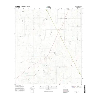
2016 Map of Ray Point
USGS Topo · Published 2016About this map
Wernli Cem sits near the northern boundary of this South Texas landscape, where the border between Bee Co and Live Oak Co runs diagonally through a terrain defined by subtle rises and drainages. The small settlement of Oaks occupies the high ground in the northeast, while Ray Point serves as a secondary focal point to the southwest near Susquehanna Western Lake. The area's agricultural and ranching character is reflected in the distribution of water features like Sulphur Tank and the various hollows that notch the hillsides, including Brush Pen Hollow, Scuffle Hollow, and Odom Hollow. Drainages like Mustang Cr and Sulphur Cr create a dendritic pattern across the quadrangle, which is also punctuated by Odom Hill. A network of county roads and farm-to-market routes, including FM 3192 and FM 2049, connects these dispersed rural communities and family-named landmarks.
Find a feature on this map
51 named features on this map. Tap any name to fly to it.
Don’t see what you’re looking for? This feature index may not catch every label — zoom into the map to look around manually.
Map Details
Editions of this 2016 Ray Point Map
This is the sole edition of this map. No revisions or reprints were ever made.
Other maps of this area

1920 · Mikeska
USGS Topo · 1:125,000

1927 · Oakville
USGS Topo · 1:62,500

1936 · Pettus
USGS Topo · 1:62,500

1953 · Crystal City
USGS Topo · 1:250,000

1953 · Beeville
USGS Topo · 1:250,000

1954 · Fleming
USGS Topo · 1:62,500

1955 · Crystal City
USGS Topo · 1:250,000

1956 · Suniland
USGS Topo · 1:62,500

1956 · Beeville
USGS Topo · 1:250,000

1956 · Pettus
USGS Topo · 1:62,500