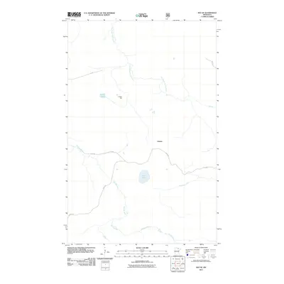
2011 Map of Ray SE
USGS Topo · Published 2011About this map
Arbutus sits at the center of this Saint Louis County landscape, where a network of forest roads and remote waterways defines the geography of northern Minnesota. The East Branch Rat Root River and the main Rat Root River meander through the terrain, joined by smaller drainages like Kinmount Creek. This 2011 survey by the U.S. Geological Survey and U.S. Forest Service documents the rural infrastructure of the region, showing established routes such as Keyes Rd, Budris Rd, and Leslie Rd. Natural landmarks like Indian Hill provide relief in a landscape otherwise dominated by small water bodies including Pearl Lake and Little Lake. The map illustrates a quiet corner of the Northwoods where the intersection of water and timber-access roads continues to shape the local character.
Find a feature on this map
13 named features on this map. Tap any name to fly to it.
Don’t see what you’re looking for? This feature index may not catch every label — zoom into the map to look around manually.
Map Details
Editions of this 2011 Ray SE Map
This is the sole edition of this map. No revisions or reprints were ever made.
Other maps of this area

1954 · International Falls
USGS Topo · 1:250,000

1957 · International Falls
USGS Topo · 1:250,000

1958 · International Falls
USGS Topo · 1:250,000

1968 · Daley Bay
USGS Topo · 1:24,000

1968 · Ash Lake
USGS Topo · 1:24,000

1968 · Ash River SW
USGS Topo · 1:24,000

1969 · Ray SE
USGS Topo · 1:24,000

1969 · Ray
USGS Topo · 1:24,000

1969 · Ray SW
USGS Topo · 1:24,000

1969 · Kabetogama
USGS Topo · 1:24,000