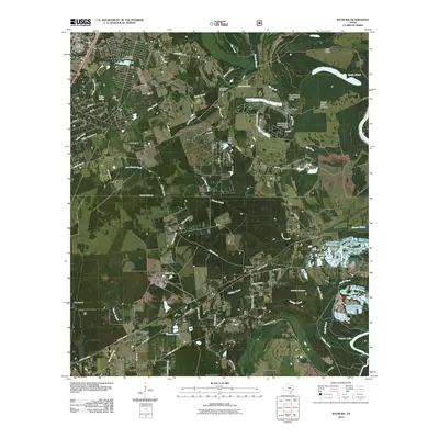
2010 Map of Rayburn
USGS Topo · Published 2010About this map
Shepherd and the surrounding piney woods settlements of San Jacinto and Liberty Counties appear in this 2010 topographic record, showing a landscape defined by creeks and timberland. The map documents a cluster of rural communities including Strington, Rayburn, and Hightower, while Dolen sits near the eastern edge. Water is a primary feature of the local geography, with the Trinity River flowing along the far eastern border and numerous small reservoirs such as Lake Tejas and Lake Water Wheel dotting the interior.
Find a feature on this map
69 named features on this map. Tap any name to fly to it.
Don’t see what you’re looking for? This feature index may not catch every label — zoom into the map to look around manually.
Map Details
Editions of this 2010 Rayburn Map
This is the sole edition of this map. No revisions or reprints were ever made.
Other maps of this area

1943 · Liberty
USGS Topo · 1:125,000

1954 · Beaumont
USGS Topo · 1:250,000

1955 · Rayburn
USGS Topo · 1:62,500

1957 · Beaumont
USGS Topo · 1:250,000

1958 · Cleveland
USGS Topo · 1:24,000

1958 · Westcott
USGS Topo · 1:24,000

1958 · Livingston
USGS Topo · 1:62,500

1960 · Camilla
USGS Topo · 1:24,000

1984 · Beaumont
USGS Topo · 1:250,000
1984 · Goodrich
USGS Topo · 1:24,000