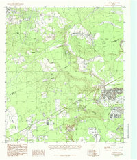
1984 Map of Rayburn
USGS Topo · Published 1985About this map
The Trinity River defines the eastern boundary of this mid-1980s landscape, where the confluence of numerous creeks and bayous shapes the local topography across the San Jacinto and Liberty County line. The settlement of Shepherd sits in the northwest, while the southeastern corner is defined by active industrial activity at the Gravel & Sand Pits near Dolen. This area is characterized by a complex drainage system featuring Coley Creek, Cherry Creek, and Winters Bayou, which flow through low-lying areas like Grama Grass Bottom.
Find a feature on this map
30 named features on this map. Tap any name to fly to it.
Don’t see what you’re looking for? This feature index may not catch every label — zoom into the map to look around manually.
Map Details
Editions of this 1984 Rayburn Map
This is the sole edition of this map. No revisions or reprints were ever made.
Other maps of this area

1943 · Liberty
USGS Topo · 1:125,000

1954 · Beaumont
USGS Topo · 1:250,000

1955 · Rayburn
USGS Topo · 1:62,500

1957 · Beaumont
USGS Topo · 1:250,000

1958 · Cleveland
USGS Topo · 1:24,000

1958 · Westcott
USGS Topo · 1:24,000

1958 · Livingston
USGS Topo · 1:62,500

1960 · Camilla
USGS Topo · 1:24,000

1984 · Beaumont
USGS Topo · 1:250,000
1984 · Goodrich
USGS Topo · 1:24,000