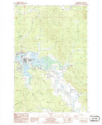
1986 Map of Raymond
USGS Topo · Published 1986About this map
The Willapa River dominates the geography of this mid-1980s Pacific County study, winding through tidal flats and feeding complex waterways like Ellis Slough. The city of Raymond sits at the river's bend, where the landscape transitions from industrial infrastructures like the Sewage Pond and various substations to the suburban residential layouts of East Raymond. To the northwest, the Butte Creek Picnic Area and a private Golf Course indicate the area's recreational land use alongside the working river.
Find a feature on this map
37 named features on this map. Tap any name to fly to it.
Don’t see what you’re looking for? This feature index may not catch every label — zoom into the map to look around manually.
Map Details
Editions of this 1986 Raymond Map
2 editions found
Other maps of this area

1938 · South Bend
USGS Topo · 1:62,500

1940 · Montesano
USGS Topo · 1:62,500

1940 · South Bend
USGS Topo · 1:62,500

1953 · Hoquiam
USGS Topo · 1:250,000

1955 · Montesano
USGS Topo · 1:62,500

1955 · Raymond
USGS Topo · 1:62,500
1955 · North Nemah
USGS Topo · 1:24,000

1955 · Aberdeen SE
USGS Topo · 1:24,000

1957 · Hoquiam
USGS Topo · 1:250,000
1957 · South Bend
USGS Topo · 1:24,000