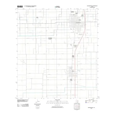
2010 Map of Raymondville
USGS Topo · Published 2010About this map
The agricultural landscape of Willacy County is defined by a dense network of irrigation and drainage infrastructure, most notably the West Main Drain which carves through the western plains. Centered on the city of Raymondville, this survey illustrates a unique pattern of residential growth characterized by various colonias and subdivisions. To the north, Colonia los Angeles and the Los Angeles Subdivision sit near the city limits, while Sandy Colonia occupies the northwestern corner. The area’s aviation history is visible through Fox Airport and Bell Airfield, supporting the region’s long-standing connection to crop-dusting and transit. Further south, the map documents the community of Lyford and nearby Bausell and Ellis Colonia. Genealogists will find local history at La Piedad Cementerio Numero Uno and its counterpart, La Piedad Cementerio Numero Dos, located along the eastern corridor near the rail line.
Find a feature on this map
69 named features on this map. Tap any name to fly to it.
Don’t see what you’re looking for? This feature index may not catch every label — zoom into the map to look around manually.
Map Details
Editions of this 2010 Raymondville Map
This is the sole edition of this map. No revisions or reprints were ever made.
Other maps of this area

1921 · Tarida Ranch
USGS Topo · 1:62,500

1922 · La Sal Vieja
USGS Topo · 1:62,500

1929 · Santa Rosa
USGS Topo · 1:24,000

1932 · Combes
USGS Topo · 1:31,680

1933 · Santa Rosa
USGS Topo · 1:31,680

1953 · Brownsville
USGS Topo · 1:250,000

1956 · San Perlita South
USGS Topo · 1:24,000

1956 · La Sal Vieja
USGS Topo · 1:24,000

1956 · San Perlita North
USGS Topo · 1:24,000

1956 · Santa Rosa
USGS Topo · 1:24,000
Featured Places
- Raymondville, TX
- Lyford, TX
- Lyford South Colonia, Lyford
- Colonia los Angeles, TX
- Raymondville Tract Number 1 Colonia, TX