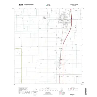
2019 Map of Raymondville
USGS Topo · Published 2019About this map
Raymondville serves as the central hub of this South Texas landscape, showing a dense grid of streets and municipal expansion just before the end of the decade. The town’s growth is evidenced by several residential developments on its periphery, including Colonia los Angeles and Ranchette Estates. This map provides significant detail for genealogists, particularly with the inclusion of La Piedad Cementerio Numero Uno, La Piedad Cementerio Numero Dos, and the older Raymondville Cem located on the eastern edge of town near Red Fish Bay RD.
Find a feature on this map
129 named features on this map. Tap any name to fly to it.
Don’t see what you’re looking for? This feature index may not catch every label — zoom into the map to look around manually.
Map Details
Editions of this 2019 Raymondville Map
This is the sole edition of this map. No revisions or reprints were ever made.
Other maps of this area

1921 · Tarida Ranch
USGS Topo · 1:62,500

1922 · La Sal Vieja
USGS Topo · 1:62,500

1929 · Santa Rosa
USGS Topo · 1:24,000

1932 · Combes
USGS Topo · 1:31,680

1933 · Santa Rosa
USGS Topo · 1:31,680

1953 · Brownsville
USGS Topo · 1:250,000

1956 · San Perlita South
USGS Topo · 1:24,000

1956 · La Sal Vieja
USGS Topo · 1:24,000

1956 · San Perlita North
USGS Topo · 1:24,000

1956 · Santa Rosa
USGS Topo · 1:24,000
Featured Places
- Raymondville, TX
- Lyford, TX
- Lyford South Colonia, Lyford
- Colonia los Angeles, TX
- Raymondville Tract Number 1 Colonia, TX