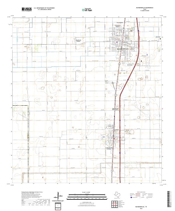
2022 Map of Raymondville
USGS Topo · Published 2022About this map
Raymondville serves as the focal point of this South Texas survey, centered on the Willacy County Courthouse and a dense grid of residential and commercial streets. The landscape is characterized by a series of colonias and residential developments that flank the primary north-south corridor, including Colonia Los Angeles, Bausell and Ellis Colonia, and Lyford South Colonia. These settlements, alongside the town of Lyford, reflect the region's agricultural and residential layout, where large open parcels are punctuated by concentrated communities and essential infrastructure like the Flying W Airport.
Find a feature on this map
111 named features on this map. Tap any name to fly to it.
Don’t see what you’re looking for? This feature index may not catch every label — zoom into the map to look around manually.
Map Details
Editions of this 2022 Raymondville Map
This is the sole edition of this map. No revisions or reprints were ever made.
Other maps of this area

1921 · Tarida Ranch
USGS Topo · 1:62,500

1922 · La Sal Vieja
USGS Topo · 1:62,500

1929 · Santa Rosa
USGS Topo · 1:24,000

1932 · Combes
USGS Topo · 1:31,680

1933 · Santa Rosa
USGS Topo · 1:31,680

1953 · Brownsville
USGS Topo · 1:250,000

1956 · San Perlita South
USGS Topo · 1:24,000

1956 · La Sal Vieja
USGS Topo · 1:24,000

1956 · San Perlita North
USGS Topo · 1:24,000

1956 · Santa Rosa
USGS Topo · 1:24,000
Featured Places
- Raymondville, TX
- Lyford, TX
- Lyford South Colonia, Lyford
- Colonia los Angeles, TX
- Raymondville Tract Number 1 Colonia, TX