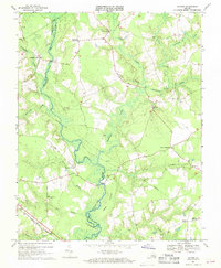
1968 Map of Raynor
USGS Topo · Published 1970About this map
The Blackwater River winds through this coastal plain landscape, serving as a natural boundary for Southampton and Isle of Wight counties. This late-1960s environment is defined by extensive wetland systems, including the tangled reaches of Rattlesnake Swamp, Terrapin Swamp, and Timber Swamp. Settlement patterns follow the higher ground between these waterways, anchored by rural intersections such as Johnson Corner, Sycamore Crossroads, and Warwick Corner.
Find a feature on this map
32 named features on this map. Tap any name to fly to it.
Don’t see what you’re looking for? This feature index may not catch every label — zoom into the map to look around manually.
Map Details
Editions of this 1968 Raynor Map
2 editions found
Other maps of this area

1907 · Yorktown
USGS Topo · 1:62,500

1919 · Smithfield
USGS Topo · 1:62,500

1919 · Surry
USGS Topo · 1:62,500

1920 · Ivor
USGS Topo · 1:62,500

1943 · Yorktown
USGS Topo · 1:62,500

1943 · Richmond
USGS Topo · 1:250,000

1944 · Windsor
USGS Topo · 1:31,680

1944 · Ivor
USGS Topo · 1:24,000

1944 · Smithfield
USGS Topo · 1:24,000

1944 · Sedley
USGS Topo · 1:24,000