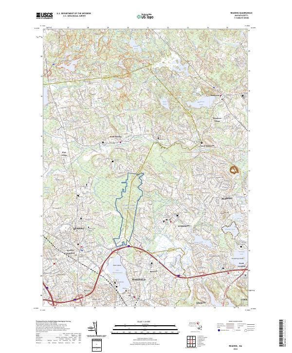
2024 Map of Reading
USGS Topo · Published 2024About this map
Lake Quannapowitt and the surrounding marshlands of Cedar Swamp define the landscape between Reading, Wakefield, and Lynnfield. This modern topographic survey highlights the extensive conversion of former industrial corridors into recreational assets, most notably the Boston & Maine Railroad Rail Trl and the Peabody Bikeway Part 1 Trl. These paths follow historic transportation routes through the Ipswich River valley, connecting established residential centers like North Reading and Montrose. Genealogists will find a dense concentration of burial sites, including the Flint Burying Ground, Riverside Cem, and the expansive Puritan Lawn Memorial Park Cem and Crematory. The large footprint of the NG MTA Camp Curtis Guil stands out as a significant military installation situated near the border of Essex and Middlesex counties.
Find a feature on this map
84 named features on this map. Tap any name to fly to it.
Don’t see what you’re looking for? This feature index may not catch every label — zoom into the map to look around manually.
Map Details
Editions of this 2024 Reading Map
This is the sole edition of this map. No revisions or reprints were ever made.
Other maps of this area

1886 · Lawrence
USGS Topo · 1:62,500

1888 · Lawrence
USGS Topo · 1:62,500

1888 · Salem
USGS Topo · 1:62,500

1892 · Boston Bay
USGS Topo · 1:62,500

1893 · Salem
USGS Topo · 1:62,500

1893 · Boston
USGS Topo · 1:62,500

1893 · Lawrence
USGS Topo · 1:62,500

1903 · Boston
USGS Topo · 1:62,500

1903 · Boston Bay
USGS Topo · 1:62,500

1917 · Salem
USGS Topo · 1:62,500