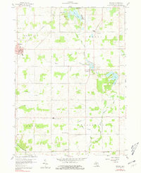
1959 Map of Reading
USGS Topo · Published 1981About this map
The New York Central railroad corridor anchors the city of Reading, serving as a primary transit artery through this portion of Hillsdale County during the mid-twentieth century. The landscape is defined by a dense network of agricultural drainage systems, including the Meade Drain, Cambria Drain, and Prouty Drain, which manage the water levels around numerous glacial lakes such as Bear Lake, Lake Wilson, and Cub Lake. The settlement at Cambria is situated along the St Joseph River near the Cambria Millpond, illustrating the historical reliance on local waterways for industry and community placement.
Find a feature on this map
37 named features on this map. Tap any name to fly to it.
Don’t see what you’re looking for? This feature index may not catch every label — zoom into the map to look around manually.
Map Details
Editions of this 1959 Reading Map
2 editions found
Other maps of this area

1914 · Pioneer
USGS Topo · 1:62,500

1939 · Clear Lake
USGS Topo · 1:24,000

1940 · Clear Lake
USGS Topo · 1:24,000

1944 · Pioneer
USGS Topo · 1:62,500

1953 · Fort Wayne
USGS Topo · 1:250,000

1956 · Fort Wayne
USGS Topo · 1:250,000

1959 · Hillsdale
USGS Topo · 1:24,000

1959 · Reading
USGS Topo · 1:24,000

1959 · North Adams
USGS Topo · 1:24,000

1959 · Frontier
USGS Topo · 1:24,000