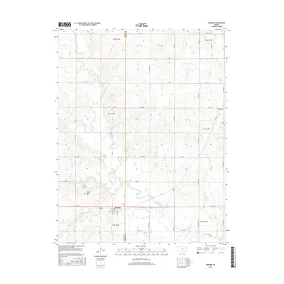
2015 Map of Reading
USGS Topo · Published 2015About this map
Reading sits near the southwestern edge of this survey, where the Marais des Cygnes River and its various tributaries such as Duck Creek and Mud Cr define the drainage of the eastern Kansas prairie. The town layout is clearly visible, showing residential streets like Chestnut St and the central Front St corridor. To the northeast, the smaller settlement of Barclay is situated near the Barclay Cem. For those tracing local history, several distinct burial grounds are documented, including Mount Calvary Cem and the Reading Cem. The landscape is characterized by a dense network of country roads, such as S Crawford Rd and S Docking Rd, which connect the rural farmsteads. The southeastern corner of the quadrangle touches the waters of Melvern Lake, illustrating how contemporary water management projects intersect with the historic stream paths of Cherry Cr and Standiford Cr.
Find a feature on this map
51 named features on this map. Tap any name to fly to it.
Don’t see what you’re looking for? This feature index may not catch every label — zoom into the map to look around manually.
Map Details
Editions of this 2015 Reading Map
This is the sole edition of this map. No revisions or reprints were ever made.
Other maps of this area

1885 · Eskridge
USGS Topo · 1:125,000

1885 · Burlington
USGS Topo · 1:125,000

1888 · Emporia
USGS Topo · 1:125,000

1889 · Burlingame
USGS Topo · 1:125,000

1889 · Eskridge
USGS Topo · 1:125,000

1894 · Emporia
USGS Topo · 1:125,000

1894 · Eskridge
USGS Topo · 1:125,000

1894 · Burlingame
USGS Topo · 1:125,000

1894 · Burlington
USGS Topo · 1:125,000

1947 · Lawrence
USGS Topo · 1:250,000