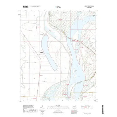
2020 Map of Readland
USGS Topo · Published 2020About this map
Grand Lake dominates the landscape of this riverfront boundary region where Chicot County meets the winding course of the Mississippi River. The settlement of Readland sits on the western shore of the lake, serving as a focal point for a rural landscape defined by complex hydrography and agricultural grid lines. This area represents a triple-point of state geography, capturing the intersection of Arkansas, Mississippi, and Louisiana.
Find a feature on this map
47 named features on this map. Tap any name to fly to it.
Don’t see what you’re looking for? This feature index may not catch every label — zoom into the map to look around manually.
Map Details
Editions of this 2020 Readland Map
This is the sole edition of this map. No revisions or reprints were ever made.
Other maps of this area

1909 · Wilsons Point
USGS Topo · 1:24,000

1909 · Millikin
USGS Topo · 1:24,000

1909 · Ashton Bridge
USGS Topo · 1:24,000

1912 · Ashton Bridge
USGS Topo · 1:31,680

1913 · Wilson Point
USGS Topo · 1:31,680

1935 · Oak Grove
USGS Topo · 1:62,500

1936 · Eudora
USGS Topo · 1:62,500

1939 · Readland
USGS Topo · 1:62,500

1939 · Mayersville
USGS Topo · 1:62,500

1953 · Greenwood
USGS Topo · 1:250,000