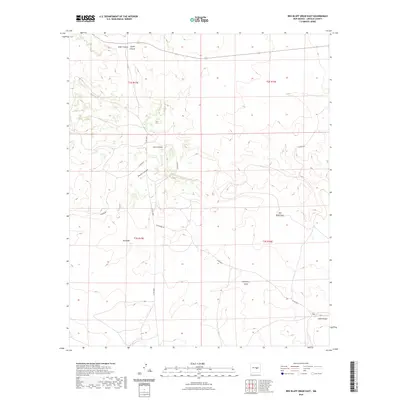
2023 Map of Red Bluff Draw East
USGS Topo · Published 2023About this map
Gallo Canyon and North Canyon converge in the northern reaches of this Lincoln County landscape, defining a network of drainage channels that flow through the arid high desert. The area is characterized by its complex topography of draws and canyons, including Jesus Canyon and the winding path of Bonita Canyon. Human presence is marked by isolated sites such as Red Bluff and Hasperos Camp, connected by a sparse grid of local routes like Hackberry Rd and Co Rd 8007. The mapping of Red Bluff Draw and Hackberry Draw reveals the natural path of seasonal water across the terrain, leading toward the Gallo Arroyo in the southeast. This survey illustrates the relationship between these remote outposts and the topographical features that dictate movement through the New Mexico backcountry.
Find a feature on this map
29 named features on this map. Tap any name to fly to it.
Don’t see what you’re looking for? This feature index may not catch every label — zoom into the map to look around manually.
Map Details
Editions of this 2023 Red Bluff Draw East Map
This is the sole edition of this map. No revisions or reprints were ever made.
Other maps of this area

1954 · Fort Sumner
USGS Topo · 1:250,000

1955 · Roswell
USGS Topo · 1:250,000

1958 · Fort Sumner
USGS Topo · 1:250,000

1958 · Roswell
USGS Topo · 1:250,000

1962 · Roswell
USGS Topo · 1:250,000

1980 · Corona
USGS Topo · 1:100,000

1981 · Gallo Spring Canyon
USGS Topo · 1:24,000

1981 · Cowboy Mesa SW
USGS Topo · 1:24,000
1981 · Cowboy Mesa NW
USGS Topo · 1:24,000
1981 · Juan Largo Canyon West
USGS Topo · 1:24,000