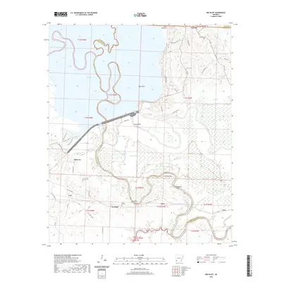
2020 Map of Red Bluff
USGS Topo · Published 2020About this map
Little River serpentines through a landscape defined by expansive wetlands and bottomlands on the border of Hempstead and Little River counties. The broad expanse of Millwood Lake dominates the northern reaches, transitioning into a dense network of water bodies such as Cypress Lake, Beard Lake, and Grassy Lake. This hydrology creates a complex system of bayous and basins, including Bee Bayou and Bee Basin, which have historically dictated the placement of settlements and transport routes away from the flood-prone lowlands.
Find a feature on this map
60 named features on this map. Tap any name to fly to it.
Don’t see what you’re looking for? This feature index may not catch every label — zoom into the map to look around manually.
Map Details
Editions of this 2020 Red Bluff Map
This is the sole edition of this map. No revisions or reprints were ever made.
Other maps of this area

1950 · Ashdown East
USGS Topo · 1:24,000

1950 · Ogden
USGS Topo · 1:24,000

1950 · Red Bluff
USGS Topo · 1:24,000

1950 · Ben Lomond
USGS Topo · 1:24,000

1951 · Ben Lomond
USGS Topo · 1:24,000

1951 · Ogden
USGS Topo · 1:24,000

1951 · Red Bluff
USGS Topo · 1:24,000

1951 · Ashdown East
USGS Topo · 1:24,000

1951 · Homan
USGS Topo · 1:24,000

1951 · Mineral Springs South
USGS Topo · 1:24,000