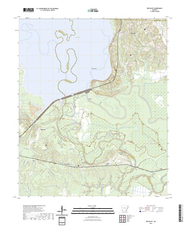
2024 Map of Red Bluff
USGS Topo · Published 2024About this map
The winding course of the Little River defines the landscape of this Arkansas territory, creating a complex network of oxbows and backwaters like Cypress Lake and Red Lake. Near the northern border, the community of Saratoga sits along State Hwy 234, anchored by Saratoga Cem and Harmony Cem. This area preserves the legacy of early river crossings, most notably Stokers Ferry, which once provided vital transit across the shifting river channels between Hempstead and Little River counties.
Find a feature on this map
60 named features on this map. Tap any name to fly to it.
Don’t see what you’re looking for? This feature index may not catch every label — zoom into the map to look around manually.
Map Details
Editions of this 2024 Red Bluff Map
This is the sole edition of this map. No revisions or reprints were ever made.
Other maps of this area

1950 · Ashdown East
USGS Topo · 1:24,000

1950 · Ogden
USGS Topo · 1:24,000

1950 · Red Bluff
USGS Topo · 1:24,000

1950 · Ben Lomond
USGS Topo · 1:24,000

1951 · Ben Lomond
USGS Topo · 1:24,000

1951 · Ogden
USGS Topo · 1:24,000

1951 · Red Bluff
USGS Topo · 1:24,000

1951 · Ashdown East
USGS Topo · 1:24,000

1951 · Homan
USGS Topo · 1:24,000

1951 · Mineral Springs South
USGS Topo · 1:24,000