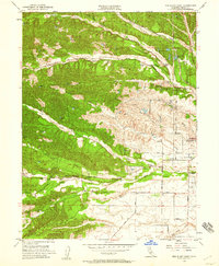
1951 Map of Red Bluff West
USGS Topo · Published 1959About this map
The western outskirts of Red Bluff and the rising foothills of Tehama County are captured here just after mid-century. A network of creeks, including Dibble Creek, Pine Creek, and Reeds Creek, carves through the landscape, dictating the placement of early infrastructure. The Southern Pacific railroad runs through the northeast corner, passing the Marion Sch and Wilcox Oaks Golf Course. Closer to the town center, community institutions like the County Hospital, St Marys Cem, and Lincoln Sch are clearly marked. Further west, the map shows the more rural character of the era with the Reeds Creek Sch and the Bidwell Airport. The terrain transitions from the developed flats of the Sacramento Valley into more complex formations like the Brickyard and the various forks of the local creek systems.
Find a feature on this map
31 named features on this map. Tap any name to fly to it.
Don’t see what you’re looking for? This feature index may not catch every label — zoom into the map to look around manually.
Map Details
Editions of this 1951 Red Bluff West Map
4 editions found

Other maps of this area

1890 · Red Bluff
USGS Topo · 1:250,000

1894 · Red Bluff
USGS Topo · 1:250,000

1905 · Tehama
USGS Topo · 1:62,500

1944 · Tuscan Buttes
USGS Topo · 1:62,500

1947 · Tuscan Buttes
USGS Topo · 1:62,500

1947 · Anderson
USGS Topo · 1:62,500

1948 · Anderson
USGS Topo · 1:62,500

1950 · Gerber
USGS Topo · 1:24,000

1951 · Gerber
USGS Topo · 1:24,000

1951 · Red Bluff East
USGS Topo · 1:24,000