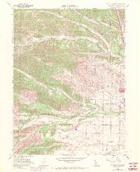
1951 Map of Red Bluff West
USGS Topo · Published 1970About this map
The western edges of Red Bluff take shape here along the rolling foothills of the Coast Range, where the irrigation and drainage patterns of the Sacramento Valley meet the higher ranch lands. The topography is defined by the braided paths of Blue Tent Creek and Dibble Creek as they cut toward the valley floor, alongside a landscape of small local schools and civic institutions. Public infrastructure is centered around the County Hospital and Lincoln Sch, while the Red Bluff Municipal Airport serves as a modern focal point on the southern flats. A complex network of country roads, such as Williams Road and Paskenta Road, links the scattered rural homesteads. The transition from town to country is marked by the Wilcox Oaks Golf Course and the presence of the Southern Pacific rail line, illustrating the area's mid-century role as a regional transportation and service hub for northern Tehama County.
Find a feature on this map
26 named features on this map. Tap any name to fly to it.
Don’t see what you’re looking for? This feature index may not catch every label — zoom into the map to look around manually.
Map Details
Editions of this 1951 Red Bluff West Map
4 editions found

Other maps of this area

1890 · Red Bluff
USGS Topo · 1:250,000

1894 · Red Bluff
USGS Topo · 1:250,000

1905 · Tehama
USGS Topo · 1:62,500

1944 · Tuscan Buttes
USGS Topo · 1:62,500

1947 · Tuscan Buttes
USGS Topo · 1:62,500

1947 · Anderson
USGS Topo · 1:62,500

1948 · Anderson
USGS Topo · 1:62,500

1950 · Gerber
USGS Topo · 1:24,000

1951 · Gerber
USGS Topo · 1:24,000

1951 · Red Bluff East
USGS Topo · 1:24,000