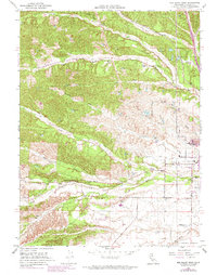
1951 Map of Red Bluff West
USGS Topo · Published 1974About this map
Red Bluff serves as the focal point of this 1951 survey, capturing the western expansion of the town and its outlying rural infrastructure before the heavy urbanization of later decades. The landscape is defined by the drainage systems of North Fork Dibble Creek, South Fork Dibble Creek, and Reeds Creek, which carve through the terrain toward the Sacramento River valley. This map highlights the distribution of mid-century community life through landmarks like Lincoln Sch, Brickyard Sch, and Reeds Creek Sch, alongside the County Hospital and St Marys Cem. The inclusion of the Southern Pacific railroad and the Red Bluff Municipal Airport illustrates the transportation networks supporting Tehama County's agricultural and regional economy. Revision data from 1969, shown in purple, reveals the early stages of suburban growth and new road developments like Begum Road and Red Bank Road intersecting the older cattle and farming lands.
Find a feature on this map
32 named features on this map. Tap any name to fly to it.
Don’t see what you’re looking for? This feature index may not catch every label — zoom into the map to look around manually.
Map Details
Editions of this 1951 Red Bluff West Map
4 editions found

Other maps of this area

1890 · Red Bluff
USGS Topo · 1:250,000

1894 · Red Bluff
USGS Topo · 1:250,000

1905 · Tehama
USGS Topo · 1:62,500

1944 · Tuscan Buttes
USGS Topo · 1:62,500

1947 · Tuscan Buttes
USGS Topo · 1:62,500

1947 · Anderson
USGS Topo · 1:62,500

1948 · Anderson
USGS Topo · 1:62,500

1950 · Gerber
USGS Topo · 1:24,000

1951 · Gerber
USGS Topo · 1:24,000

1951 · Red Bluff East
USGS Topo · 1:24,000