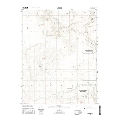
2017 Map of Red Breaks
USGS Topo · Published 2017About this map
The Escalante River winds through this high-desert canyon landscape, defining the topography of eastern Garfield County. The terrain is characterized by expansive plateaus and eroded formations such as Big Spencer Flats and the namesake Red Breaks. These geological features reflect the complex drainage patterns of the region, where the Harris Wash and Death Hollow intersect the river system. Much of the eastern portion of the map is preserved within the Glen Canyon National Recreation Area, highlighting the significance of these public lands.
Find a feature on this map
20 named features on this map. Tap any name to fly to it.
Don’t see what you’re looking for? This feature index may not catch every label — zoom into the map to look around manually.
Map Details
Editions of this 2017 Red Breaks Map
This is the sole edition of this map. No revisions or reprints were ever made.
Other maps of this area

1886 · Escalante
USGS Topo · 1:250,000

1953 · Circle Cliffs 4 NW
USGS Topo · 1:24,000

1953 · Circle Cliffs 1 SW
USGS Topo · 1:24,000

1953 · Circle Cliffs 4 SW
USGS Topo · 1:24,000

1953 · Moody Creek
USGS Topo · 1:62,500
1953 · Wagon Box Mesa
USGS Topo · 1:62,500

1956 · Escalante
USGS Topo · 1:250,000

1960 · Escalante
USGS Topo · 1:250,000

1964 · Sunset Flat
USGS Topo · 1:24,000

1964 · Tenmile Flat
USGS Topo · 1:24,000