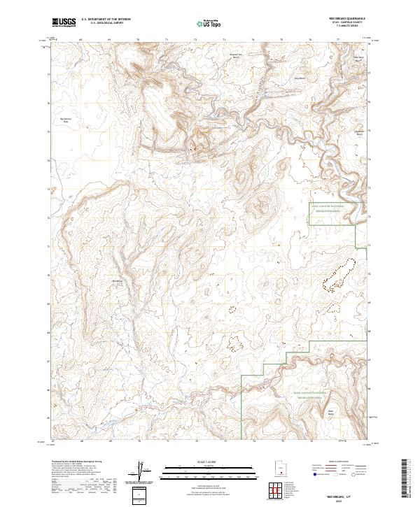
2023 Map of Red Breaks
USGS Topo · Published 2023About this map
Glen Canyon National Recreation Area dominates the eastern and southern portions of this Garfield County landscape, where deep canyons and high desert benches meet. The Escalante River winds through the northern section, joined by prominent drainage systems like The Gulch and Horse Canyon. The topography is defined by significant elevation changes, ranging from the low-lying Big Spencer Flats to named overlooks such as King Bench and Brigham Tea Bench. This survey provides a precise look at the backcountry access routes of the modern era, including the Harris Wash Trl following the course of Harris Wash toward the southeast. The interior is marked by the namesake Red Breaks, a complex of sandstone formations that illustrate the distinct erosion patterns of the Colorado Plateau. This 2023 edition reflects the contemporary management of these public lands, capturing the intersection of federally protected recreation areas and the open range.
Find a feature on this map
13 named features on this map. Tap any name to fly to it.
Don’t see what you’re looking for? This feature index may not catch every label — zoom into the map to look around manually.
Map Details
Editions of this 2023 Red Breaks Map
This is the sole edition of this map. No revisions or reprints were ever made.
Other maps of this area

1886 · Escalante
USGS Topo · 1:250,000

1953 · Circle Cliffs 4 NW
USGS Topo · 1:24,000

1953 · Circle Cliffs 1 SW
USGS Topo · 1:24,000

1953 · Circle Cliffs 4 SW
USGS Topo · 1:24,000

1953 · Moody Creek
USGS Topo · 1:62,500
1953 · Wagon Box Mesa
USGS Topo · 1:62,500

1956 · Escalante
USGS Topo · 1:250,000

1960 · Escalante
USGS Topo · 1:250,000

1964 · Sunset Flat
USGS Topo · 1:24,000

1964 · Tenmile Flat
USGS Topo · 1:24,000