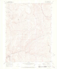
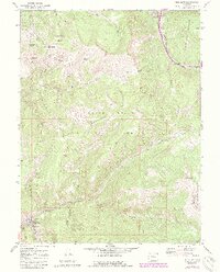
1970 Map of Red Cliff
USGS Topo · Published 1973About this map
Red Cliff serves as the focal point of this high-elevation Colorado survey, situated at the confluence of the Eagle River and Turkey Creek. The 1970 data reflects a landscape defined by its transition from early industrial extraction to alpine recreation. To the south, evidence of the area's silver and gold mining legacy is preserved in labels for the Hornsilver Mine, Liberty Mine, and a Kiln, while the D & Rg W Rr tracks follow the river's winding path through the canyon.
Find a feature on this map
43 named features on this map. Tap any name to fly to it.
Don’t see what you’re looking for? This feature index may not catch every label — zoom into the map to look around manually.
Map Details
Editions of this 1970 Red Cliff Map
5 editions found
Other maps of this area

1889 · Leadville
USGS Topo · 1:125,000

1891 · Leadville
USGS Topo · 1:125,000

1929 · Dillon
USGS Topo · 1:62,500

1934 · Climax
USGS Topo · 1:48,000

1934 · Minturn
USGS Topo · 1:62,500

1934 · Dillon
USGS Topo · 1:62,500

1938 · Mt. Lincoln
USGS Topo · 1:48,000

1942 · Leadville
USGS Topo · 1:125,000

1945 · Mount Lincoln
USGS Topo · 1:62,500

1949 · Holy Cross
USGS Topo · 1:62,500