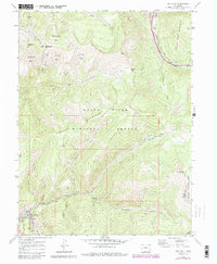
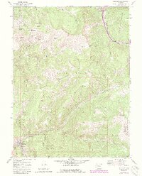
1970 Map of Red Cliff
USGS Topo · Published 1988About this map
Red Cliff (Redcliff PO) sits at the confluence of the Eagle River and Turkey Creek, serving as a focal point for this high-altitude region during the late 1960s and 1970s. The landscape is a study in contrasting land uses, from the industrial remnants of the Liberty Mine and Hornsilver Mine near Battle Mountain to the emerging recreation infrastructure at Vail Mountain. Significant terrain features like Ptarmigan Point and the series of bowls—including China Bowl and Sundown Bowl—illustrate the transition of the White River National Forest into a premier skiing destination.
Find a feature on this map
41 named features on this map. Tap any name to fly to it.
Don’t see what you’re looking for? This feature index may not catch every label — zoom into the map to look around manually.
Map Details
Editions of this 1970 Red Cliff Map
5 editions found
Other maps of this area

1889 · Leadville
USGS Topo · 1:125,000

1891 · Leadville
USGS Topo · 1:125,000

1929 · Dillon
USGS Topo · 1:62,500

1934 · Climax
USGS Topo · 1:48,000

1934 · Minturn
USGS Topo · 1:62,500

1934 · Dillon
USGS Topo · 1:62,500

1938 · Mt. Lincoln
USGS Topo · 1:48,000

1942 · Leadville
USGS Topo · 1:125,000

1945 · Mount Lincoln
USGS Topo · 1:62,500

1949 · Holy Cross
USGS Topo · 1:62,500