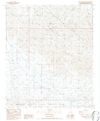
1986 Map of Red Cloud Canyon
USGS Topo · Published 1986About this map
The Chuckwalla Mountains dominate this 1980s landscape, a region defined by its rugged desert washes and a history of remote mining operations. The map highlights the legacy of extraction in the area, specifically centering on the Red Cloud Mine, Great Western Mine, and Model Mine. Numerous unnamed Prospects are scattered across the terrain, particularly near Red Cloud Canyon, suggesting a significant period of mineral exploration.
Find a feature on this map
23 named features on this map. Tap any name to fly to it.
Don’t see what you’re looking for? This feature index may not catch every label — zoom into the map to look around manually.
Map Details
Editions of this 1986 Red Cloud Canyon Map
2 editions found
Other maps of this area

1940 · Frink
USGS Topo · 1:62,500

1940 · Iris Pass
USGS Topo · 1:62,500

1940 · Canyon Spring
USGS Topo · 1:62,500

1943 · Canyon Spring
USGS Topo · 1:62,500

1944 · Chuckwalla Mountains
USGS Topo · 1:62,500

1944 · Frink
USGS Topo · 1:62,500

1945 · Iris Pass
USGS Topo · 1:62,500

1954 · Salton Sea
USGS Topo · 1:250,000

1955 · Salton Sea
USGS Topo · 1:250,000
1956 · Frink
USGS Topo · 1:62,500