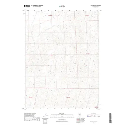
2018 Map of Red Cow Creek
USGS Topo · Published 2018About this map
The Tuscarora Mountains dominate the landscape of this high-desert portion of Elko County, where the topography is defined by intricate drainage networks feeding into the Humboldt River basin. Water sources are vital in this arid environment, evidenced by the courses of Chino Cr, Amazon Cr, and Red Cow Cr as they navigate the mountain slopes. The land is strictly partitioned by the Public Land Survey System, with the intersections of several townships—including t41n r49e and t41n r50e—marking the administrative history of Nevada's ranching and mining heartland. This 2018 survey provides a precise record of the elevation contours and natural water features that have dictated land use in the region for generations.
Find a feature on this map
11 named features on this map. Tap any name to fly to it.
Don’t see what you’re looking for? This feature index may not catch every label — zoom into the map to look around manually.
Map Details
Editions of this 2018 Red Cow Creek Map
This is the sole edition of this map. No revisions or reprints were ever made.
Other maps of this area

1955 · McDermitt
USGS Topo · 1:250,000

1956 · Mt. Blitzen
USGS Topo · 1:62,500

1959 · McDermitt
USGS Topo · 1:250,000

1964 · Wilson Reservoir
USGS Topo · 1:62,500

1973 · Little Rock Creek
USGS Topo · 1:24,000

1974 · Soldier Cap
USGS Topo · 1:24,000

1974 · Middle Draw Reservoir
USGS Topo · 1:24,000

1982 · Bull Run Mts
USGS Topo · 1:100,000

1982 · Tuscarora
USGS Topo · 1:100,000
1987 · Toe Jam Mountain
USGS Topo · 1:24,000