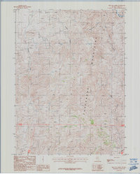
1987 Map of Red Cow Creek
USGS Topo · Published 1987About this map
The Tuscarora Mountains dominate this high-desert landscape in northern Nevada, where an intricate network of drainages flows toward the Owyhee River in the northeast corner. This 1987 survey documents a period of active or recent geological exploration, evidenced by scattered mining activity throughout the rugged terrain. Small-scale resource extraction is marked by an Adit, a Mine Dump, and numerous Prospects that follow the mountain ridges and canyon walls.
Find a feature on this map
15 named features on this map. Tap any name to fly to it.
Don’t see what you’re looking for? This feature index may not catch every label — zoom into the map to look around manually.
Map Details
Editions of this 1987 Red Cow Creek Map
This is the sole edition of this map. No revisions or reprints were ever made.
Other maps of this area

1955 · McDermitt
USGS Topo · 1:250,000

1956 · Mt. Blitzen
USGS Topo · 1:62,500

1959 · McDermitt
USGS Topo · 1:250,000

1964 · Wilson Reservoir
USGS Topo · 1:62,500

1973 · Little Rock Creek
USGS Topo · 1:24,000

1974 · Soldier Cap
USGS Topo · 1:24,000

1974 · Middle Draw Reservoir
USGS Topo · 1:24,000

1982 · Bull Run Mts
USGS Topo · 1:100,000

1982 · Tuscarora
USGS Topo · 1:100,000
1987 · Toe Jam Mountain
USGS Topo · 1:24,000