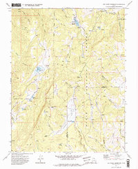
1971 Map of Red Creek Reservoir
USGS Topo · Published 1975About this map
Dixie National Forest defines the character of this high-elevation landscape, where the headwaters of the Red Creek system are carefully managed for water storage. The Red Creek Reservoir, monitored by a Gaging Station, serves as the primary water feature, though the terrain is dotted with diverse hydrological markers like the Co-op Valley Sinks and the high-altitude Hoosier Lake. The transition between the Iron County and Garfield County line is marked by a network of pack trails and jeep tracks, indicating a region utilized for seasonal grazing and remote resource management rather than permanent settlement.
Find a feature on this map
45 named features on this map. Tap any name to fly to it.
Don’t see what you’re looking for? This feature index may not catch every label — zoom into the map to look around manually.
Map Details
Editions of this 1971 Red Creek Reservoir Map
2 editions found
Other maps of this area

1886 · Kanab
USGS Topo · 1:250,000

1953 · Cedar City
USGS Topo · 1:250,000

1958 · Cedar City
USGS Topo · 1:250,000

1958 · Cedar Breaks
USGS Topo · 1:62,500

1958 · Panguitch Lake
USGS Topo · 1:62,500

1962 · Cedar City
USGS Topo · 1:250,000

1971 · Paragonah
USGS Topo · 1:24,000
1971 · Cottonwood Mtn
USGS Topo · 1:24,000

1971 · Fivemile Ridge
USGS Topo · 1:24,000

1971 · Parowan
USGS Topo · 1:24,000