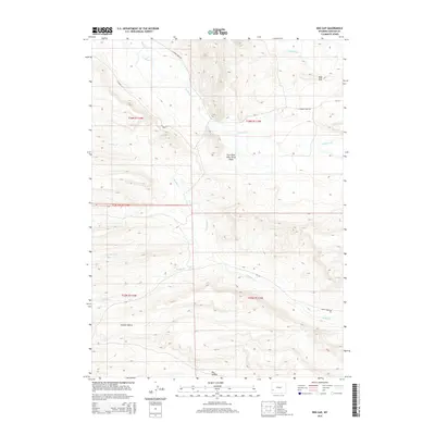
2015 Map of Red Gap
USGS Topo · Published 2015About this map
Red Gap defines the high-altitude landscape of Lincoln County in this 2015 U.S. Geological Survey representation. The terrain is a network of drainages and notable elevation points, including the uniquely named Five Slash Fifty-Three Knoll and deep depressions such as Holden Hollow and Dry Hollow. Waterways dictate the movement through this area, with La Barge Cr and its northern branch winding through the northern sections, while Muddy Cr and Little Muddy Cr carve paths through the southern townships.
Find a feature on this map
20 named features on this map. Tap any name to fly to it.
Don’t see what you’re looking for? This feature index may not catch every label — zoom into the map to look around manually.
Map Details
Editions of this 2015 Red Gap Map
This is the sole edition of this map. No revisions or reprints were ever made.
Other maps of this area

1945 · Fort Hill
USGS Topo · 1:62,500

1947 · Fort Hill
USGS Topo · 1:62,500

1955 · Preston
USGS Topo · 1:250,000

1958 · Preston
USGS Topo · 1:250,000

1962 · Preston
USGS Topo · 1:250,000

1968 · Names Hill
USGS Topo · 1:24,000

1968 · Fontenelle Reservoir SW
USGS Topo · 1:24,000

1969 · La Barge
USGS Topo · 1:24,000
1969 · The Hogsback
USGS Topo · 1:24,000
1969 · Lake Mountain
USGS Topo · 1:24,000