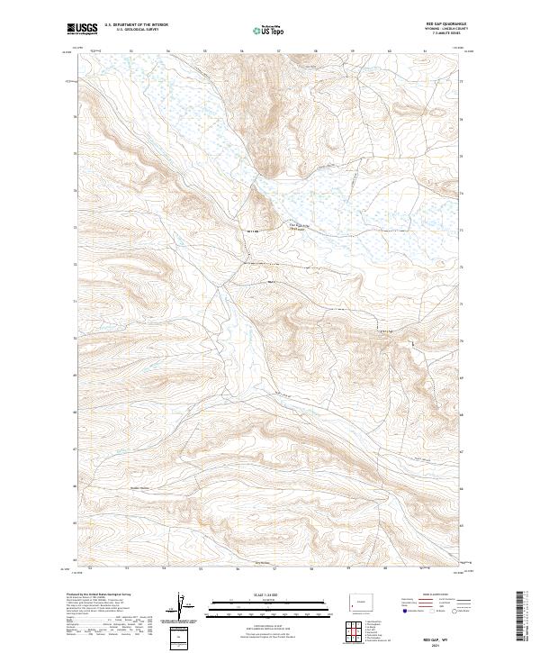
2021 Map of Red Gap
USGS Topo · Published 2021About this map
La Barge Cr and its complex wetlands define this corner of Lincoln County, where the high desert terrain is carved by a network of seasonal and perennial drainages. The landscape is marked by the presence of the Salli Mine in the northern hills, while the agricultural and water-management history of the region is evident in the Anderson Howard Canal and several rural roads like La Barge Creek Rd. The topography shifts between high points like Five Slash Fifty-Three Knoll and carved depressions such as Holden Hollow and Dry Hollow. This modern survey reveals a rugged interior where several branches of the Muddy Creek system, including Little Muddy Cr and N Muddy Cr, converge within the public land survey grid.
Find a feature on this map
21 named features on this map. Tap any name to fly to it.
Don’t see what you’re looking for? This feature index may not catch every label — zoom into the map to look around manually.
Map Details
Editions of this 2021 Red Gap Map
This is the sole edition of this map. No revisions or reprints were ever made.
Other maps of this area

1945 · Fort Hill
USGS Topo · 1:62,500

1947 · Fort Hill
USGS Topo · 1:62,500

1955 · Preston
USGS Topo · 1:250,000

1958 · Preston
USGS Topo · 1:250,000

1962 · Preston
USGS Topo · 1:250,000

1968 · Names Hill
USGS Topo · 1:24,000

1968 · Fontenelle Reservoir SW
USGS Topo · 1:24,000

1969 · La Barge
USGS Topo · 1:24,000
1969 · The Hogsback
USGS Topo · 1:24,000
1969 · Lake Mountain
USGS Topo · 1:24,000