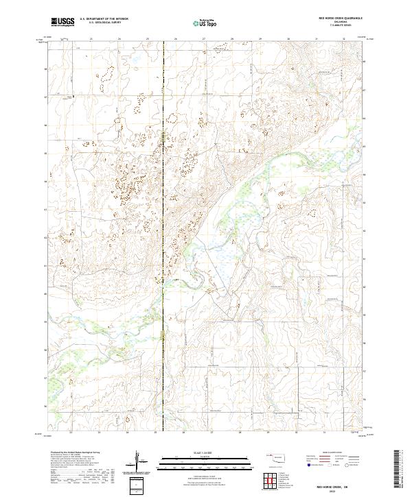
2022 Map of Red Horse Creek
USGS Topo · Published 2022About this map
The Texas Co and Beaver Co line bisects this landscape of the Oklahoma Panhandle, where the wide corridor of the Beaver River serves as the central geographic anchor. The river is fed by a network of intermittent drainage ways including Red Horse Cr, Bull Cr, and Fulton Cr, reflecting the arid hydrology of the High Plains. While the area is dominated by large-scale section-line surveying, localized landmarks such as the Union Center Cem near Mile 58 offer specific points of interest for genealogists and local historians. The map documents a sparsely populated ranching or farming region defined by a strict grid of rural routes, such as Hollow E0190 and S Rd, which navigate the subtle elevation changes of the river breaks and surrounding plateaus.
Find a feature on this map
40 named features on this map. Tap any name to fly to it.
Don’t see what you’re looking for? This feature index may not catch every label — zoom into the map to look around manually.
Map Details
Editions of this 2022 Red Horse Creek Map
This is the sole edition of this map. No revisions or reprints were ever made.
Other maps of this area

1954 · Perryton
USGS Topo · 1:250,000

1958 · Perryton
USGS Topo · 1:250,000

1967 · Adams
USGS Topo · 1:24,000

1968 · Hardesty SE
USGS Topo · 1:24,000

1968 · Hardesty NE
USGS Topo · 1:24,000

1973 · Boyd
USGS Topo · 1:24,000

1973 · Bryans Corner SW
USGS Topo · 1:24,000

1973 · Turpin East
USGS Topo · 1:24,000

1973 · Red Horse Creek
USGS Topo · 1:24,000

1973 · Bryans Corner
USGS Topo · 1:24,000