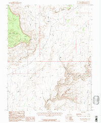
1987 Map of Red House Spring
USGS Topo · Published 1987About this map
Red House Cliffs and the adjacent Clay Hills define the dramatic verticality of this San Juan County landscape during the late 1980s. The region is characterized by deep drainage systems, most notably Grand Gulch and Collins Canyon, which converge in a complex network of rimrock and seasonal water sources. Natural landmarks like The Narrows indicate where these canyons constrict, while vital water points such as Red House Spring and Collins Spring provided essential resources in an otherwise arid environment. This provisional survey captures the intersection of high plateaus like Polly Mesa with the lower, winding drainages of Steer Gulch and Water Canyon, illustrating the topographical challenges faced by early travelers and surveyors navigating the southeastern Utah desert.
Find a feature on this map
14 named features on this map. Tap any name to fly to it.
Don’t see what you’re looking for? This feature index may not catch every label — zoom into the map to look around manually.
Map Details
Editions of this 1987 Red House Spring Map
2 editions found
Other maps of this area

1886 · Henry Mountains
USGS Topo · 1:250,000

1892 · Henry Mountains
USGS Topo · 1:250,000

1952 · Mancos Mesa
USGS Topo · 1:62,500

1952 · Natural Bridges
USGS Topo · 1:62,500

1954 · White Canyon 3 SE
USGS Topo · 1:24,000

1954 · White Canyon 4 SE
USGS Topo · 1:24,000

1954 · White Canyon 4 SW
USGS Topo · 1:24,000

1954 · Clay Hills 2 NE
USGS Topo · 1:24,000

1954 · Clay Hills 2 SE
USGS Topo · 1:24,000

1954 · Clay Hills 1 NW
USGS Topo · 1:24,000