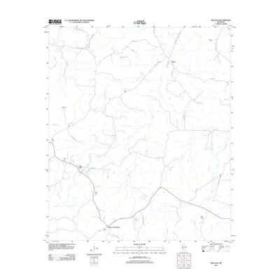
2012 Map of Red Lick
USGS Topo · Published 2012About this map
Red Lick and the surrounding Jefferson County landscape are defined by a network of rural roads and creek drainages in this 2012 study. The area is marked by numerous family and community burial grounds, including Cherry Hill Cem, Beech Hill Cem, and Stephens Cem near Dennis Crossroads. These sites, along with others like Darden Cem and Little Zion Cem, offer significant geographic markers for local history and genealogical research.
Find a feature on this map
45 named features on this map. Tap any name to fly to it.
Don’t see what you’re looking for? This feature index may not catch every label — zoom into the map to look around manually.
Map Details
Editions of this 2012 Red Lick Map
This is the sole edition of this map. No revisions or reprints were ever made.
Other maps of this area

1939 · Lorman
USGS Topo · 1:62,500

1953 · Natchez
USGS Topo · 1:250,000

1956 · Natchez
USGS Topo · 1:250,000

1958 · St. Joseph
USGS Topo · 1:62,500

1959 · Natchez
USGS Topo · 1:250,000

1962 · Fayette
USGS Topo · 1:62,500

1963 · Port Gibson
USGS Topo · 1:24,000

1963 · Red Lick
USGS Topo · 1:24,000

1963 · Union Church
USGS Topo · 1:62,500
1963 · Hermanville
USGS Topo · 1:24,000