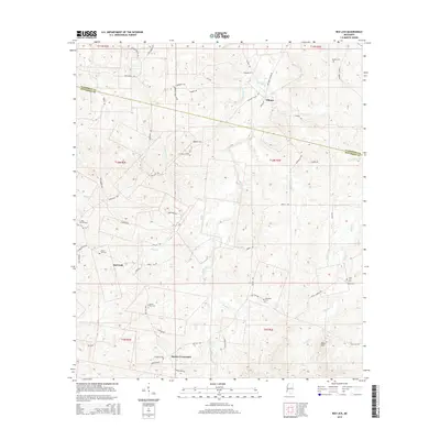
2015 Map of Red Lick
USGS Topo · Published 2015About this map
Red Lick and Tillman anchor this pocket of southwest Mississippi, where the headwaters of numerous creeks carve a complex drainage pattern through the landscape. The region is defined by its rural cemetery network, including Beech Hill Cem, Cherry Hill Cem, and the uniquely named Homeless Cem, each serving as a vital touchstone for local genealogical research. Small settlements like Dennis Crossroads and Blue Hill are linked by a web of local roads such as Pattison Tillman Rd and Red Lick Rd. Streams including Willis Cr, Brady Cr, and Zion Cr thread through the terrain, illustrating the natural boundaries that shaped early land divisions and settlement locations near the Claiborne and Jefferson County line.
Find a feature on this map
57 named features on this map. Tap any name to fly to it.
Don’t see what you’re looking for? This feature index may not catch every label — zoom into the map to look around manually.
Map Details
Editions of this 2015 Red Lick Map
This is the sole edition of this map. No revisions or reprints were ever made.
Other maps of this area

1939 · Lorman
USGS Topo · 1:62,500

1953 · Natchez
USGS Topo · 1:250,000

1956 · Natchez
USGS Topo · 1:250,000

1958 · St. Joseph
USGS Topo · 1:62,500

1959 · Natchez
USGS Topo · 1:250,000

1962 · Fayette
USGS Topo · 1:62,500

1963 · Port Gibson
USGS Topo · 1:24,000

1963 · Red Lick
USGS Topo · 1:24,000

1963 · Union Church
USGS Topo · 1:62,500
1963 · Hermanville
USGS Topo · 1:24,000