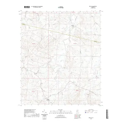
2020 Map of Red Lick
USGS Topo · Published 2020About this map
Red Lick and Tillman anchor this interior landscape of Jefferson and Claiborne Counties, where the terrain is carved by a network of creeks including Bakers Cr, Brady Cr, and Willis Cr. The road network, often following the winding paths of ridges and valleys, connects smaller hubs like Dennis Crossroads and Blue Hill. Numerous family and community burial sites are documented across the countryside, such as Wade Cem and Stephens Cem, providing a detailed record for genealogists tracing ancestral roots in this corner of Mississippi.
Find a feature on this map
54 named features on this map. Tap any name to fly to it.
Don’t see what you’re looking for? This feature index may not catch every label — zoom into the map to look around manually.
Map Details
Editions of this 2020 Red Lick Map
This is the sole edition of this map. No revisions or reprints were ever made.
Other maps of this area

1939 · Lorman
USGS Topo · 1:62,500

1953 · Natchez
USGS Topo · 1:250,000

1956 · Natchez
USGS Topo · 1:250,000

1958 · St. Joseph
USGS Topo · 1:62,500

1959 · Natchez
USGS Topo · 1:250,000

1962 · Fayette
USGS Topo · 1:62,500

1963 · Port Gibson
USGS Topo · 1:24,000

1963 · Red Lick
USGS Topo · 1:24,000

1963 · Union Church
USGS Topo · 1:62,500
1963 · Hermanville
USGS Topo · 1:24,000