
1963 Map of Red Lick
USGS Topo · Published 1964About this map
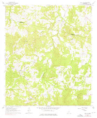
Tillman and Red Lick anchor this mid-century survey of the Mississippi countryside, situated along the Illinois Central railroad corridor. The landscape is defined by a dense network of rural landmarks, particularly small churches and family cemeteries that offer significant value for genealogical research. Notable sites include the uniquely named Homeless Cem, Wade Cem, and Tillman Chapel. The map also captures the local hydrography with Willis Creek and Whetstone Creek winding through the terrain. A notable geopolitical marker, the Choctaw Base Line, runs along the northern edge of the sheet, delineating the historical surveying framework of the region near the border of Claiborne and Jefferson Counties. This 1963 field-checked study provides an intimate view of Mississippi's rural social geography before modern development altered these small communities.
Find a feature on this map
32 named features on this map. Tap any name to fly to it.
Don’t see what you’re looking for? This feature index may not catch every label — zoom into the map to look around manually.
Map Details
Editions of this 1963 Red Lick Map
2 editions found
Other maps of this area

1939 · Lorman
USGS Topo · 1:62,500

1953 · Natchez
USGS Topo · 1:250,000

1956 · Natchez
USGS Topo · 1:250,000

1958 · St. Joseph
USGS Topo · 1:62,500

1959 · Natchez
USGS Topo · 1:250,000

1962 · Fayette
USGS Topo · 1:62,500

1963 · Port Gibson
USGS Topo · 1:24,000

1963 · Union Church
USGS Topo · 1:62,500
1963 · Hermanville
USGS Topo · 1:24,000

1963 · McBride
USGS Topo · 1:24,000