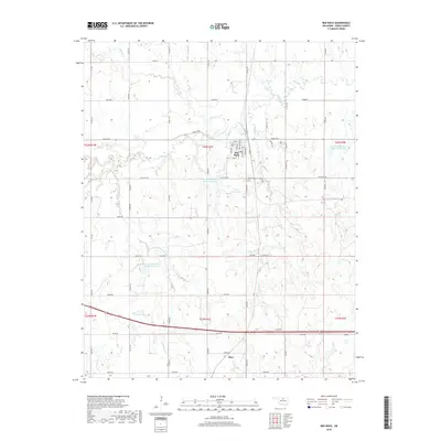
2018 Map of Red Rock
USGS Topo · Published 2018About this map
Red Rock serves as the primary hub of this Noble County landscape, where a traditional grid of streets like Main St, Anna Ave, and Hitchcock Ave meets the meandering course of Red Rock Cr. The surrounding terrain is defined by a sophisticated system of water management, evidenced by several specialized catchments including Lower Red Rock Cr Site 18 Reservoir, Lower Red Rock Cr Site 21 Reservoir, and the 103006 Reservoir. To the south, the community of Otoe marks a distinct point of settlement near the junction of Co Rd 170 and E0430 Rd. Genealogists and local historians can locate the Red Rock Cem situated east of the town center. The map meticulously documents the drainage patterns of the prairie, following the paths of Skinny Cr, Legend Cr, and Cottonwood Cr across the section lines of the Public Land Survey System.
Find a feature on this map
57 named features on this map. Tap any name to fly to it.
Don’t see what you’re looking for? This feature index may not catch every label — zoom into the map to look around manually.
Map Details
Editions of this 2018 Red Rock Map
This is the sole edition of this map. No revisions or reprints were ever made.
Other maps of this area

1955 · Enid
USGS Topo · 1:250,000

1958 · Enid
USGS Topo · 1:250,000

1968 · Tonkawa SE
USGS Topo · 1:24,000

1968 · Marland
USGS Topo · 1:24,000

1968 · Ponca City SE
USGS Topo · 1:24,000

1972 · Morrison NE
USGS Topo · 1:24,000

1972 · Morrison
USGS Topo · 1:24,000

1972 · Red Rock
USGS Topo · 1:24,000

1972 · Ceres
USGS Topo · 1:24,000

1972 · Perry
USGS Topo · 1:24,000