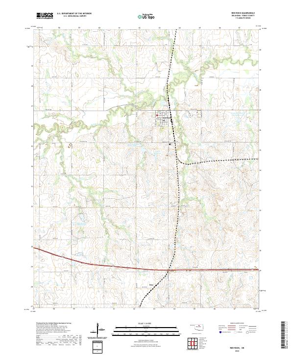
2022 Map of Red Rock
USGS Topo · Published 2022About this map
Red Rock serves as the central hub of this Noble County landscape, where the local street grid intersects near the Po and the Red Rock Cem. The area is defined by the drainage of Red Rock Cr and its many tributaries, including Skinny Cr, Legend Cr, and Cottonwood Cr. The modern hydrology of the region is notably modified by a series of containment structures, such as the Lower Red Rock Cr Site 23 Reservoir and 103006 Reservoir, which manage the flow through this prairie terrain. To the south, the settlement of Otoe sits near the junction of E0430 Rd and N3260 Rd, reflecting the indigenous heritage of the Otoe-Missouria people in this portion of Oklahoma. A network of rural section-line roads, including Valley Rd and Ute Bluff Rd, connects the scattered farmsteads and agricultural plots that dominate the township.
Find a feature on this map
58 named features on this map. Tap any name to fly to it.
Don’t see what you’re looking for? This feature index may not catch every label — zoom into the map to look around manually.
Map Details
Editions of this 2022 Red Rock Map
This is the sole edition of this map. No revisions or reprints were ever made.
Other maps of this area

1955 · Enid
USGS Topo · 1:250,000

1958 · Enid
USGS Topo · 1:250,000

1968 · Tonkawa SE
USGS Topo · 1:24,000

1968 · Marland
USGS Topo · 1:24,000

1968 · Ponca City SE
USGS Topo · 1:24,000

1972 · Morrison NE
USGS Topo · 1:24,000

1972 · Morrison
USGS Topo · 1:24,000

1972 · Red Rock
USGS Topo · 1:24,000

1972 · Ceres
USGS Topo · 1:24,000

1972 · Perry
USGS Topo · 1:24,000