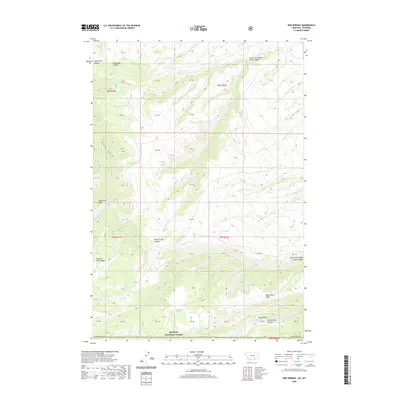
2020 Map of Red Springs
USGS Topo · Published 2020About this map
Bighorn National Forest dominates the southern reaches of this high-elevation landscape where the border between Montana and Wyoming meets. The terrain is defined by a series of prominent northwest-trending divides, most notably Telephone Ridge and Buffalo Horn Ridge, which separate deeply incised drainages. These canyons, including Rotten Grass Canyon and Lodge Grass Canyon, represent a complex hydrologic network that feeds into larger regional basins. Local water sources are critical features in this arid environment, marked by sites such as Red Springs, Paint Springs, and Tepee Pole Spring. The map detail captures the intersection of multiple survey townships and the transition from national forest land into the adjacent canyons and ridges of the Big Horn County region.
Find a feature on this map
42 named features on this map. Tap any name to fly to it.
Don’t see what you’re looking for? This feature index may not catch every label — zoom into the map to look around manually.
Map Details
Editions of this 2020 Red Springs Map
This is the sole edition of this map. No revisions or reprints were ever made.
Other maps of this area

1894 · St. Xavier
USGS Topo · 1:125,000

1898 · Bald Mountain
USGS Topo · 1:125,000

1901 · St. Xavier
USGS Topo · 1:125,000

1901 · Bald Mountain
USGS Topo · 1:125,000

1954 · Hardin
USGS Topo · 1:250,000

1955 · Sheridan
USGS Topo · 1:250,000

1957 · Hardin
USGS Topo · 1:250,000

1958 · Hardin
USGS Topo · 1:250,000

1958 · Sheridan
USGS Topo · 1:250,000

1960 · Boyd Ridge
USGS Topo · 1:24,000